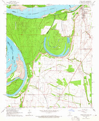
1964 Map of Friars Point
USGS Topo · Published 1965About this map
Friars Point occupies a critical position on the east bank of the Mississippi River, where the landscape is defined by the shifting hydrology of the Delta. The 1964 survey captures a terrain marked by relic watercourses and protective infrastructure, most notably the massive curve of Horseshoe Lake and its interior Dustin Pond. This area is heavy with ancestral sites, including several Indian Mounds situated near Richies Bayou and Stovall.
Find a feature on this map
36 named features on this map. Tap any name to fly to it.
Don’t see what you’re looking for? This feature index may not catch every label — zoom into the map to look around manually.
Map Details
Editions of this 1964 Friars Point Map
2 editions found
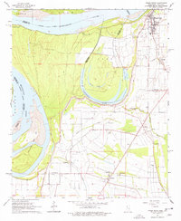
Other maps of this area

1908 · Coahoma
USGS Topo · 1:24,000

1908 · Moon Lake
USGS Topo · 1:24,000

1910 · Coahoma
USGS Topo · 1:31,680

1912 · Moon Lake
USGS Topo · 1:31,680

1930 · Mellwood
USGS Topo · 1:62,500

1935 · Clarksdale
USGS Topo · 1:62,500

1939 · Farrell
USGS Topo · 1:62,500

1939 · Modoc
USGS Topo · 1:62,500

1939 · Clarksdale
USGS Topo · 1:62,500

1939 · Mellwood
USGS Topo · 1:62,500