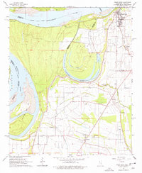
1964 Map of Friars Point
USGS Topo · Published 1978About this map
The Mississippi River defines the western edge of this landscape, separating Arkansas from the alluvial plains of Coahoma County. The town of Friars Point sits protected behind an extensive levee system, showing a concentrated grid of streets and a prominent water tank near the riverbank. Further south, the dramatic meander of Horseshoe Lake and the smaller Dustin Pond illustrate the shifting nature of the river's historical course.
Find a feature on this map
35 named features on this map. Tap any name to fly to it.
Don’t see what you’re looking for? This feature index may not catch every label — zoom into the map to look around manually.
Map Details
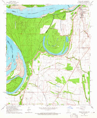
Editions of this 1964 Friars Point Map
2 editions found
Other maps of this area

1908 · Coahoma
USGS Topo · 1:24,000

1908 · Moon Lake
USGS Topo · 1:24,000

1910 · Coahoma
USGS Topo · 1:31,680

1912 · Moon Lake
USGS Topo · 1:31,680

1930 · Mellwood
USGS Topo · 1:62,500

1935 · Clarksdale
USGS Topo · 1:62,500

1939 · Farrell
USGS Topo · 1:62,500

1939 · Modoc
USGS Topo · 1:62,500

1939 · Clarksdale
USGS Topo · 1:62,500

1939 · Mellwood
USGS Topo · 1:62,500