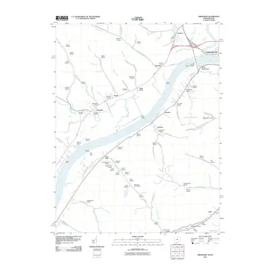
2010 Map of Friendship
USGS Topo · Published 2010About this map
The Ohio River serves as the dominant geographical and industrial border on this 2010 map, separating the riverfront communities of Ohio and Kentucky. In the northern reaches, the city of Portsmouth and South Portsmouth are connected by the Carl Perkins Memorial Bridge, while smaller river landings like Infirmary Landing, Manuel Mocres Landing, and Saint Pauls Landing suggest a landscape deeply tied to the waterway. Inland, the terrain is defined by a dense network of hollows and lick branches, including Bellamy Hollow, Crane Hollow, and Scaffold Lick.
Find a feature on this map
112 named features on this map. Tap any name to fly to it.
Don’t see what you’re looking for? This feature index may not catch every label — zoom into the map to look around manually.
Map Details
Editions of this 2010 Friendship Map
This is the sole edition of this map. No revisions or reprints were ever made.
Other maps of this area

1911 · Sciotoville
USGS Topo · 1:62,500

1913 · Sciotoville
USGS Topo · 1:62,500

1915 · Garrison
USGS Topo · 1:62,500

1915 · Otway
USGS Topo · 1:62,500

1917 · Otway
USGS Topo · 1:62,500

1918 · Garrison
USGS Topo · 1:62,500

1926 · Greenup
USGS Topo · 1:48,000

1930 · Greenup
USGS Topo · 1:62,500

1949 · Pond Run
USGS Topo · 1:24,000

1949 · Garrison
USGS Topo · 1:24,000