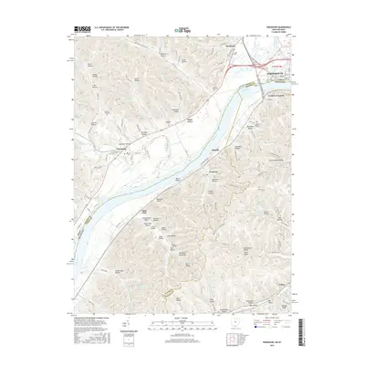
2016 Map of Friendship
USGS Topo · Published 2016About this map
The Ohio River acts as a dividing line between Ohio and Kentucky on this mid-2010s survey, with the industrial and residential outskirts of Portsmouth appearing in the northeast corner where the Scioto River joins the main channel. The landscape is characterized by a dense network of steep hollows and ridges, many bearing family names that serve as essential markers for genealogists. To the west, the settlement of Friendship is situated near Turkey Creek, while across the water in Kentucky, Saint Paul and South Portsmouth anchor the southern bank.
Find a feature on this map
121 named features on this map. Tap any name to fly to it.
Don’t see what you’re looking for? This feature index may not catch every label — zoom into the map to look around manually.
Map Details
Editions of this 2016 Friendship Map
This is the sole edition of this map. No revisions or reprints were ever made.
Other maps of this area

1911 · Sciotoville
USGS Topo · 1:62,500

1913 · Sciotoville
USGS Topo · 1:62,500

1915 · Garrison
USGS Topo · 1:62,500

1915 · Otway
USGS Topo · 1:62,500

1917 · Otway
USGS Topo · 1:62,500

1918 · Garrison
USGS Topo · 1:62,500

1926 · Greenup
USGS Topo · 1:48,000

1930 · Greenup
USGS Topo · 1:62,500

1949 · Pond Run
USGS Topo · 1:24,000

1949 · Garrison
USGS Topo · 1:24,000