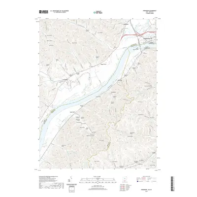
2019 Map of Friendship
USGS Topo · Published 2019About this map
The Ohio River dominates this landscape, serving as the defining border between Ohio and Kentucky near the confluence with the Scioto River. The city of Portsmouth anchors the northeastern corner, where the County Courthouse and a dense grid of streets like Front St and 2nd St transition into the crossing at the Carl Perkins Memorial Bridge. To the southwest, the terrain transforms into a dense network of steep hollows and narrow ridges, such as Zorns Hollow and Opossum Hollow, illustrating the deeply dissected topography typical of the region.
Find a feature on this map
128 named features on this map. Tap any name to fly to it.
Don’t see what you’re looking for? This feature index may not catch every label — zoom into the map to look around manually.
Map Details
Editions of this 2019 Friendship Map
This is the sole edition of this map. No revisions or reprints were ever made.
Other maps of this area

1911 · Sciotoville
USGS Topo · 1:62,500

1913 · Sciotoville
USGS Topo · 1:62,500

1915 · Garrison
USGS Topo · 1:62,500

1915 · Otway
USGS Topo · 1:62,500

1917 · Otway
USGS Topo · 1:62,500

1918 · Garrison
USGS Topo · 1:62,500

1926 · Greenup
USGS Topo · 1:48,000

1930 · Greenup
USGS Topo · 1:62,500

1949 · Pond Run
USGS Topo · 1:24,000

1949 · Garrison
USGS Topo · 1:24,000