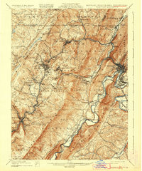
1908 Map of Frostburg
USGS Topo · Published 1932About this map
Savage Mountain and Dans Mountain dominate this early 20th-century landscape, framing a dense industrial corridor of coal mining and heavy rail. The map reveals the intricate network of the Cumberland and Pennsylvania RR and the Baltimore and Ohio RR as they navigate the steep valleys of Georges Creek and Jennings Run. Mining life is centered around specialized operations like Eckhart Mines, Borden Shaft, and Midlothian, while the historic National Road cuts across the northern ridges. In the southeast, the Potomac River flows alongside the C & O Canal, serving as a critical artery for transport between Maryland and West Virginia. From the bustling streets of Frostburg to the smaller settlements of Vale Summit and Lonaconing, the map captures a period when regional commerce was defined by the extraction of natural resources and the iron rails that carried them to market.
Find a feature on this map
85 named features on this map. Tap any name to fly to it.
Don’t see what you’re looking for? This feature index may not catch every label — zoom into the map to look around manually.
Map Details
Editions of this 1908 Frostburg Map
5 editions found
Other maps of this area

1891 · Romney
USGS Topo · 1:125,000

1895 · Piedmont
USGS Topo · 1:125,000

1898 · Frostburg
USGS Topo · 1:62,500

1899 · Flintstone
USGS Topo · 1:62,500

1899 · Grantsville
USGS Topo · 1:62,500

1900 · Flintstone
USGS Topo · 1:62,500

1901 · Frostburg
USGS Topo · 1:62,500

1904 · Grantsville
USGS Topo · 1:62,500

1908 · Frostburg
USGS Topo · 1:62,500

1919 · Elk Garden
USGS Topo · 1:48,000