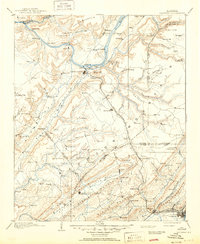
1956 Map of Gadsden
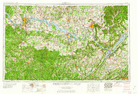
USGS Topo · Published 1978About this map
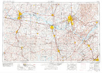
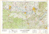
The Tennessee River corridor dominates this regional perspective of North Alabama, showing a landscape defined by massive impoundments and growing mid-century industrial hubs. Major centers like Huntsville, Decatur, and the Shoals tri-cities of Florence, Sheffield, and Tuscumbia anchor the northern reaches, while Gadsden and Attalla mark the southeastern foothills. The infrastructure of the space age is evident at the Redstone Arsenal and Marshall Space Flight Center, contrasting with the wilderness of the William B Bankhead National Forest to the west. Broad plateaus and ridges including Sand Mountain and Brindley Mountain shape the settlement patterns between the river valley and the interior highlands. This survey documents the intersection of federal conservation, military research, and the established Tennessee Valley Authority river system during a period of significant regional expansion.
Find a feature on this map
113 named features on this map. Tap any name to fly to it.
Don’t see what you’re looking for? This feature index may not catch every label — zoom into the map to look around manually.
Map Details
Editions of this 1956 Gadsden Map
3 editions found

Historical Maps of Huntsville Through Time
9 maps found