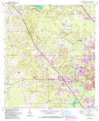
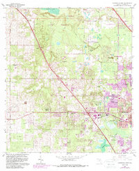
1966 Map of Gainesville West
USGS Topo · Published 1993About this map
San Felasco State Preserve dominates the northern landscape of this Alachua County quadrangle, where the transition from dense hammock to open wetlands like Sanchez Prairie is clearly defined. The area around Gainesville shows significant suburban expansion, with developments such as Suburban Heights and Beville Heights pushing westward. A notable geological feature is the Devils Millhopper, protected within its own state geological site. The presence of the University of Florida Agricultural Experimental Station and the University of Florida Experimental Farm highlights the region's academic and agricultural heritage. Further south, the terrain opens into Hogtown Prairie, while smaller communities like Los Trancos Woods and Rutledge are scattered throughout the wooded sections. Local history is preserved in landmarks such as Mt Nebo Cem and Greater Liberty Hill Ch.
Find a feature on this map
46 named features on this map. Tap any name to fly to it.
Don’t see what you’re looking for? This feature index may not catch every label — zoom into the map to look around manually.
Map Details
Editions of this 1966 Gainesville West Map
6 editions found
Other maps of this area

1890 · Arredondo
USGS Topo · 1:62,500

1892 · Arredondo
USGS Topo · 1:62,500

1894 · Arredondo
USGS Topo · 1:62,500

1954 · Gainesville
USGS Topo · 1:250,000

1958 · Gainesville
USGS Topo · 1:250,000

1959 · Gainesville
USGS Topo · 1:250,000

1962 · High Springs
USGS Topo · 1:24,000
1966 · Micanopy
USGS Topo · 1:24,000

1966 · Gainesville West
USGS Topo · 1:24,000

1966 · Arredondo
USGS Topo · 1:24,000