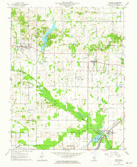
1963 Map of Galatia
USGS Topo · Published 1964About this map
Harrisburg Reservoir dominates the northwestern landscape of this Saline County survey, providing a focal point for a region defined by its water systems and extractive industry. The Middle Fork Saline River and Bankston Fork wind through the southern and central sections, surrounded by a dense network of Oil Wells and active oil fields. This 1960s snapshot shows the intersection of the Illinois Central and New York Central railroads, which facilitated the movement of coal and oil from nearby Carrier Mills.
Find a feature on this map
47 named features on this map. Tap any name to fly to it.
Don’t see what you’re looking for? This feature index may not catch every label — zoom into the map to look around manually.
Map Details
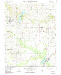
Editions of this 1963 Galatia Map
2 editions found
Other maps of this area

1905 · Eldorado
USGS Topo · 1:62,500

1906 · Eldorado
USGS Topo · 1:62,500

1908 · Galatia
USGS Topo · 1:62,500

1916 · Equality
USGS Topo · 1:62,500

1925 · Harrisburg
USGS Topo · 1:62,500

1938 · Galatia
USGS Topo · 1:62,500

1939 · Harrisburg
USGS Topo · 1:62,500

1949 · Paducah
USGS Topo · 1:250,000

1950 · Paducah
USGS Topo · 1:250,000

1954 · Paducah
USGS Topo · 1:250,000