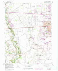
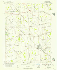
1966 Map of Galloway
USGS Topo · Published 1982About this map
Big Darby Creek and Little Darby Creek define the western edge of this landscape, where the rural character of Franklin and Madison counties begins to meet the expanding suburban footprint of Columbus. The map illustrates a transitional era during the late 1960s and early 1980s, documenting established small communities like Alton, Galloway, and Georgesville alongside new developments. The presence of numerous schools and local landmarks, such as Prairie-Lincoln Sch and the Alton-Hall Sch, indicates the post-war growth of residential neighborhoods. Transportation is a central theme, with the Conrail rail lines and National Road bisecting the terrain. Regional aviation is represented by Bolton Airfield and the Columbus Southwest Airport, while local history is preserved in small burial grounds like Clover Cem and Ebenezer Cem.
Find a feature on this map
62 named features on this map. Tap any name to fly to it.
Don’t see what you’re looking for? This feature index may not catch every label — zoom into the map to look around manually.
Map Details
Editions of this 1966 Galloway Map
4 editions found
Other maps of this area

1901 · Dublin
USGS Topo · 1:62,500

1903 · Dublin
USGS Topo · 1:62,500

1907 · London
USGS Topo · 1:62,500

1916 · Milford Center
USGS Topo · 1:62,500

1923 · West Columbus
USGS Topo · 1:62,500

1925 · West Columbus
USGS Topo · 1:62,500

1944 · Milford Center
USGS Topo · 1:62,500

1947 · Columbus
USGS Topo · 1:250,000

1950 · Marion
USGS Topo · 1:250,000
1954 · Hilliard
USGS Topo · 1:24,000