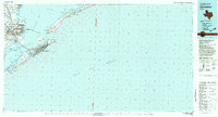
1983 Map of Galveston
USGS Topo · Published 1983About this map
Galveston Island and the Bolivar Peninsula frame this 1983 coastal survey, showcasing a complex network of barrier islands, bayous, and maritime infrastructure. The geography is defined by the deep waters of Bolivar Roads and the Intracoastal Waterway, which link Galveston Bay to the Gulf of Mexico. On the mainland, industrial and residential expansion is evident in Texas City and La Marque, while the Texas City Dike extends significantly into the bay waters.
Find a feature on this map
61 named features on this map. Tap any name to fly to it.
Don’t see what you’re looking for? This feature index may not catch every label — zoom into the map to look around manually.
Map Details
Editions of this 1983 Galveston Map
This is the sole edition of this map. No revisions or reprints were ever made.
Other maps of this area

1916 · Seabrook
USGS Topo · 1:24,000

1920 · Seabrook
USGS Topo · 1:31,680

1929 · Dickinson
USGS Topo · 1:24,000

1929 · Karankawa Lake
USGS Topo · 1:24,000

1929 · Hitchcock
USGS Topo · 1:24,000

1929 · Virginia Point
USGS Topo · 1:24,000

1929 · Texas City
USGS Topo · 1:24,000

1930 · Galveston
USGS Topo · 1:24,000

1931 · Lake Como
USGS Topo · 1:24,000

1931 · Flake
USGS Topo · 1:24,000