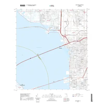
2018 Map of Gandy Bridge
USGS Topo · Published 2018About this map
The waters of Old Tampa Bay and the Gulf Of Mexico dominate this 2018 survey, illustrating the complex coastal connections between Tampa and St. Petersburg. Large-scale infrastructure defines the modern landscape, most notably the sprawling Tampa International Airport and the massive spans of the Gandy Bridge and Howard Frankland Bridge crossing the bay. On the eastern shore, the Interbay Peninsula shows a dense urban grid reaching down to the historic neighborhood of Rattlesnake.
Find a feature on this map
152 named features on this map. Tap any name to fly to it.
Don’t see what you’re looking for? This feature index may not catch every label — zoom into the map to look around manually.
Map Details
Editions of this 2018 Gandy Bridge Map
This is the sole edition of this map. No revisions or reprints were ever made.
Other maps of this area

1921 · Tampa
USGS Topo · 1:62,500

1921 · St Petersburg
USGS Topo · 1:62,500

1943 · St Petersburg
USGS Topo · 1:31,680

1943 · Gandy Bridge
USGS Topo · 1:31,680

1943 · Safety Harbor
USGS Topo · 1:31,680

1943 · Port Tampa
USGS Topo · 1:31,680

1943 · Oldsmar
USGS Topo · 1:24,000

1944 · Sulphur Springs
USGS Topo · 1:31,680

1944 · Tampa
USGS Topo · 1:31,680

1944 · Oldsmar
USGS Topo · 1:31,680