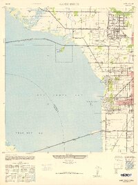
1947 Map of Gandy Bridge
USGS Topo · Published 1947About this map
Drew Field Military Reservation dominates the northern landscape of this mid-century survey, showcasing a significant military footprint during the post-war era. The installation includes specialized facilities like a Sub-Machine Gun Range and Rifle Range, alongside WAC Housing and the Airport Golf Course. To the south, the expansion of Tampa is evident through residential developments such as Beach Park, Sunset Park, and Bel Mar, which are organized into distinct numbered precincts.
Find a feature on this map
51 named features on this map. Tap any name to fly to it.
Don’t see what you’re looking for? This feature index may not catch every label — zoom into the map to look around manually.
Map Details
Editions of this 1947 Gandy Bridge Map
2 editions found
Other maps of this area

1921 · Tampa
USGS Topo · 1:62,500

1921 · St Petersburg
USGS Topo · 1:62,500

1943 · St Petersburg
USGS Topo · 1:31,680

1943 · Gandy Bridge
USGS Topo · 1:31,680

1943 · Safety Harbor
USGS Topo · 1:31,680

1943 · Port Tampa
USGS Topo · 1:31,680

1943 · Oldsmar
USGS Topo · 1:24,000

1944 · Sulphur Springs
USGS Topo · 1:31,680

1944 · Tampa
USGS Topo · 1:31,680

1944 · Oldsmar
USGS Topo · 1:31,680