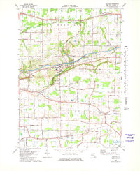
1979 Map of Gasport
USGS Topo · Published 1979About this map
Gasport serves as a central hub for this Niagara County landscape, where the industrial legacy of the Erie Canal and Conrail lines intersect with rural farmsteads. The settlement pattern is defined by historic crossroads such as Terrys Corners, McNalls, and Johnson Creek, each marking the steady growth of the Hartland and Royalton townships. Local community life is anchored by the Hartland Central Sch and the Hartland Ch, while the surrounding terrain is etched by the East Branch Eighteenmile Creek.
Find a feature on this map
47 named features on this map. Tap any name to fly to it.
Don’t see what you’re looking for? This feature index may not catch every label — zoom into the map to look around manually.
Map Details
Editions of this 1979 Gasport Map
2 editions found
Other maps of this area

1897 · Olcott
USGS Topo · 1:62,500

1897 · Medina
USGS Topo · 1:62,500

1897 · Lockport
USGS Topo · 1:62,500

1897 · Ridgeway
USGS Topo · 1:62,500

1899 · Niagara
USGS Topo · 1:125,000

1902 · Lockport
USGS Topo · 1:62,500

1905 · Lockport
USGS Topo · 1:62,500

1948 · Lockport
USGS Topo · 1:62,500

1948 · Olcott
USGS Topo · 1:62,500
1949 · Barker
USGS Topo · 1:24,000