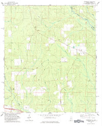
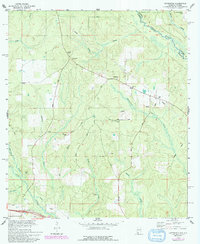
1978 Map of Gateswood
USGS Topo · Published 1984About this map
Gateswood stands as a focal point in this Baldwin County landscape, situated along a network of country roads near the Alabama-Florida state line during the late 1970s. The terrain is defined by the winding course of the Perdido River and the Styx River, with numerous smaller waterways like Nuke Branch and Nelson Branch carving through the area. Industry and infrastructure are evident through several scattered Claypits, an Oil Well, and a network of Pipelines, while the presence of the Lookout Tower and La Floresta Perdida Airport highlights the region's managed timber and aviation history. Local community life is anchored by landmarks such as New Hope Ch, the Bellefontaine Sch, and family burial grounds including Hamilton Cem and Pittman Cem. The map also traces the physical legacy of transportation with an Old Railroad Grade cutting across the central section.
Find a feature on this map
33 named features on this map. Tap any name to fly to it.
Don’t see what you’re looking for? This feature index may not catch every label — zoom into the map to look around manually.
Map Details
Editions of this 1978 Gateswood Map
5 editions found
Other maps of this area

1920 · Robertsdale
USGS Topo · 1:62,500

1921 · Muscogee
USGS Topo · 1:62,500

1941 · Muscogee
USGS Topo · 1:62,500

1941 · Robertsdale
USGS Topo · 1:62,500

1941 · Century
USGS Topo · 1:62,500

1942 · Dyas
USGS Topo · 1:62,500

1943 · Robertsdale
USGS Topo · 1:62,500

1943 · Muscogee
USGS Topo · 1:62,500

1943 · Century
USGS Topo · 1:62,500
1944 · Muscogee
USGS Topo · 1:25,000