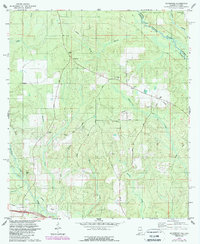
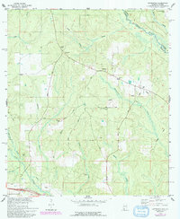
1978 Map of Gateswood
USGS Topo · Published 1985About this map
The Perdido River and Styx River define the wooded landscape of eastern Baldwin County in the late 1970s. This survey records a period of land use transition, where early transportation routes like the Old Railroad Grade and Railroad Grade are superseded by New Hope Road and modern service infrastructure, including several pipelines and a Meter Sta. The small settlement at Gateswood serves as a local hub, anchored by its Lookout Tower.
Find a feature on this map
30 named features on this map. Tap any name to fly to it.
Don’t see what you’re looking for? This feature index may not catch every label — zoom into the map to look around manually.
Map Details
Editions of this 1978 Gateswood Map
5 editions found
Other maps of this area

1920 · Robertsdale
USGS Topo · 1:62,500

1921 · Muscogee
USGS Topo · 1:62,500

1941 · Muscogee
USGS Topo · 1:62,500

1941 · Robertsdale
USGS Topo · 1:62,500

1941 · Century
USGS Topo · 1:62,500

1942 · Dyas
USGS Topo · 1:62,500

1943 · Robertsdale
USGS Topo · 1:62,500

1943 · Muscogee
USGS Topo · 1:62,500

1943 · Century
USGS Topo · 1:62,500
1944 · Muscogee
USGS Topo · 1:25,000