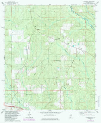
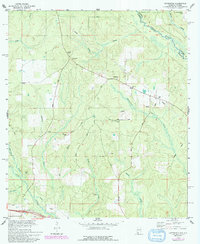
1978 Map of Gateswood
USGS Topo · Published 1985About this map
The Perdido River forms the natural boundary between Alabama and Florida in this late 1970s survey, anchoring a landscape defined by timber, transit, and rural community life. The small settlement of Gateswood serves as a local hub, supported by the Lookout Tower nearby. This area illustrates the transition from rail-based industry to modern utility corridors, evidenced by the Old Railroad Grade running through the southern terrain alongside contemporary Pipelines. Genealogists will find significant value in the distribution of community centers like New Hope Ch and Hamilton Ch, each accompanied by their respective cemeteries, New Hope Cem and Hamilton Cem. The presence of several Claypits and an Oil Well suggests a land-use pattern focused on resource extraction, while the Bellefontaine Sch marks the site of local education in this creek-veined corner of Baldwin Co.
Find a feature on this map
32 named features on this map. Tap any name to fly to it.
Don’t see what you’re looking for? This feature index may not catch every label — zoom into the map to look around manually.
Map Details
Editions of this 1978 Gateswood Map
5 editions found
Other maps of this area

1920 · Robertsdale
USGS Topo · 1:62,500

1921 · Muscogee
USGS Topo · 1:62,500

1941 · Muscogee
USGS Topo · 1:62,500

1941 · Robertsdale
USGS Topo · 1:62,500

1941 · Century
USGS Topo · 1:62,500

1942 · Dyas
USGS Topo · 1:62,500

1943 · Robertsdale
USGS Topo · 1:62,500

1943 · Muscogee
USGS Topo · 1:62,500

1943 · Century
USGS Topo · 1:62,500
1944 · Muscogee
USGS Topo · 1:25,000