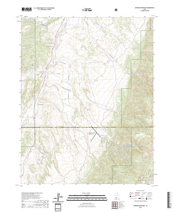
2023 Map of George Mountain
USGS Topo · Published 2023About this map
Bryce Woodland Estates anchors the southern portion of this high-plateau landscape, where the residential development meets the expansive Dixie National Forest. The Sevier River and Asay Creek cut through the western terrain, creating a natural corridor followed by Old US Hwy 89. This modern survey illustrates the intersection of recreation and geography, featuring the Bryce Woodland Estates Landing Strip and a dense network of local roads like Ponderosa Dr and Kaibab Cir. To the east, the elevation rises sharply toward George Mtn and the Sunset Cliffs, highlighting the dramatic transition from the river valley to the rugged escarpments of the Garfield and Kane county line. The map captures the specialized land use of the early 21st century, from the Big Hollow Trl for backcountry access to the scattered homesteads and seasonal properties that define this part of the Utah wilderness.
Find a feature on this map
50 named features on this map. Tap any name to fly to it.
Don’t see what you’re looking for? This feature index may not catch every label — zoom into the map to look around manually.
Map Details
Editions of this 2023 George Mountain Map
This is the sole edition of this map. No revisions or reprints were ever made.
Other maps of this area

1886 · Kanab
USGS Topo · 1:250,000

1953 · Cedar City
USGS Topo · 1:250,000

1958 · Cedar City
USGS Topo · 1:250,000

1958 · Orderville
USGS Topo · 1:62,500

1958 · Panguitch Lake
USGS Topo · 1:62,500

1962 · Cedar City
USGS Topo · 1:250,000

1966 · Wilson Peak
USGS Topo · 1:24,000

1966 · Alton
USGS Topo · 1:24,000

1966 · Hatch
USGS Topo · 1:24,000

1966 · George Mtn
USGS Topo · 1:24,000