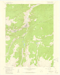
1957 Map of Georgetown
USGS Topo · Published 1959About this map
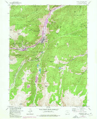
Georgetown and Silver Plume anchor this mid-century look at the Clear Creek mining district, where the industrial legacy of the Silver Boom remains etched into the landscape. The steep mountain slopes are riddled with historic workings, from the Seven Thirty Mine and Molly Bawn Mine to deep drainage and access points like the Lebanon Tunnel and Edgar Tunnel. Evidence of the area's complex transportation history is visible in the Old Railroad Grade winding through the narrow canyon alongside Clear Creek. High-altitude features like Green Lake and Lake Edith sit tucked between peaks such as Republican Mountain and Griffith Mountain, while the Griffin Monument stands as a solitary landmark above Silver Plume. The map also captures the local infrastructure of the era, including the Georgetown Reservoir Dam and various Jeep Trails providing access to the high backcountry within the Arapaho National Forest.
Find a feature on this map
84 named features on this map. Tap any name to fly to it.
Don’t see what you’re looking for? This feature index may not catch every label — zoom into the map to look around manually.
Map Details
Editions of this 1957 Georgetown Map
7 editions found
Other maps of this area

1903 · Georgetown
USGS Topo · 1:62,500

1905 · Central City
USGS Topo · 1:62,500

1905 · Georgetown
USGS Topo · 1:62,500

1910 · Central City
USGS Topo · 1:62,500

1912 · Central City
USGS Topo · 1:62,500

1924 · Montezuma
USGS Topo · 1:62,500

1924 · Fraser
USGS Topo · 1:62,500

1926 · Fraser
USGS Topo · 1:62,500

1926 · Montezuma
USGS Topo · 1:62,500

1933 · Montezuma
USGS Topo · 1:62,500