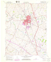
1965 Map of Georgetown
USGS Topo · Published 1979About this map
The town of Georgetown serves as the heart of this survey, anchored by the campus of Georgetown College and the historical Royal Spring site. Situated in Scott County near the border of Fayette County, the area showcases a classic Bluegrass landscape defined by thoroughbred culture and educational institutions. To the south, the sprawling grounds of the Kentucky State Horse Park and the Steeplechase Racetrack highlight the region's deep equestrian roots, while the University of Kentucky Agricultural Experimental Station indicates its role in local scientific advancement.
Find a feature on this map
53 named features on this map. Tap any name to fly to it.
Don’t see what you’re looking for? This feature index may not catch every label — zoom into the map to look around manually.
Map Details
Editions of this 1965 Georgetown Map
4 editions found
Other maps of this area

1906 · Georgetown
USGS Topo · 1:62,500

1908 · Georgetown
USGS Topo · 1:62,500

1927 · Lexington
USGS Topo · 1:48,000

1929 · Cynthiana
USGS Topo · 1:48,000

1929 · Lexington
USGS Topo · 1:62,500

1934 · Cynthiana
USGS Topo · 1:62,500

1939 · Sadieville
USGS Topo · 1:62,500

1950 · Lexington East
USGS Topo · 1:24,000

1950 · Lexington West
USGS Topo · 1:24,000

1952 · Midway
USGS Topo · 1:24,000