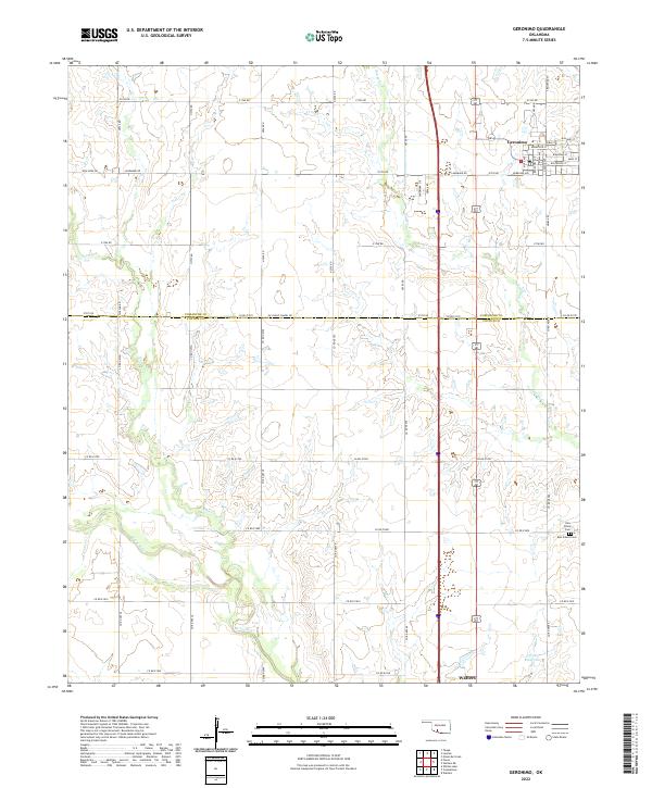
2022 Map of Geronimo
USGS Topo · Published 2022About this map
Geronimo serves as the primary hub of this landscape, where the grid of a settled prairie community meets the expansive agriculture of the southern Oklahoma plains. The town's street names—ranging from Minnesota St to Kiowa Ave—reflect a blend of regional and tribal influences typical of the former Oklahoma Territory. As the land slopes toward the Cotton Co border, the terrain is shaped by the drainages of Snake Cr, Pecan Cr, and W Cache Cr, which create intricate contours across the sections. Genealogists and local historians will find significant markers of the area's rural heritage in the southeastern corner, including Elm Grove Cem and New Salem Cem. Near the southern boundary, the map captures the northern outskirts of Walters, indicating the connection between these neighboring communities via a network of section line roads like Landmark Rd and New Hope Rd.
Find a feature on this map
41 named features on this map. Tap any name to fly to it.
Don’t see what you’re looking for? This feature index may not catch every label — zoom into the map to look around manually.
Map Details
Editions of this 2022 Geronimo Map
This is the sole edition of this map. No revisions or reprints were ever made.
Other maps of this area

1937 · Cache
USGS Topo · 1:48,000

1942 · Cache
USGS Topo · 1:62,500

1946 · Lawton
USGS Topo · 1:62,500

1955 · Lawton
USGS Topo · 1:250,000

1956 · Ninemile Creek
USGS Topo · 1:24,000
1956 · Taupa
USGS Topo · 1:24,000

1956 · Lawton
USGS Topo · 1:24,000
1956 · Cache
USGS Topo · 1:62,500

1956 · Lawton
USGS Topo · 1:62,500

1962 · Chattanooga
USGS Topo · 1:62,500