
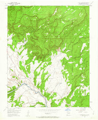
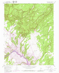
1953 Map of Ghost Ranch
USGS Topo · Published 1955About this map
Piedra Lumbre Grant lands dominate this northern New Mexico landscape, where the wide valley of Llano de la Piedra Lumbre meets the steep escarpments of the Carson National Forest. The 1950s era finds Ghost Ranch established near the foothills of Mesa Montosa, complete with its own Airstrip and neighboring El Monte Rojo. This territory is defined by its drainage systems, with the Rio Chama cutting through the southern portion of the sheet, fed by numerous arroyos such as Arroyo del Cobre and Arroyo Seco. Evidence of earlier activity is visible at the CCC Camp (Aband) near Comanche Canyon, while traditional water sources like Ojitos de los Gatos and Iron Spring remain important landmarks in this arid environment of mesas and mesas, including the prominent Mesa del Yeso.
Find a feature on this map
27 named features on this map. Tap any name to fly to it.
Don’t see what you’re looking for? This feature index may not catch every label — zoom into the map to look around manually.
Map Details
Editions of this 1953 Ghost Ranch Map
Other maps of this area

1909 · Gallina
USGS Topo · 1:125,000

1918 · Abiquiu
USGS Topo · 1:125,000

1953 · Canones
USGS Topo · 1:24,000

1953 · Abiquiu
USGS Topo · 1:24,000

1953 · Alire
USGS Topo · 1:24,000

1953 · Echo Ampitheater
USGS Topo · 1:24,000

1953 · Magote Peak
USGS Topo · 1:24,000

1953 · Canjilon
USGS Topo · 1:24,000

1953 · Canjilon SE
USGS Topo · 1:24,000

1953 · Youngsville
USGS Topo · 1:24,000