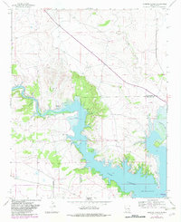
1966 Map of Gibbons Ranch
USGS Topo · Published 1982About this map
Sumner Lake dominates this mid-century landscape where the Guadalupe and De Baca County line crosses the water. The map documents the impoundment of the Pecos River, showing the intricate shoreline and the surrounding Sumner Lake State Park. Settlement patterns are sparse, defined by local landmarks such as Gibbons Ranch and the ruins at Los Ojitos. Small-scale evidence of early community life remains, including a lonely Cem and several Springs that likely dictated early habitation in this arid region. The drainage network of Arroyo Potrillo and Alamogordo Creek illustrates the complex topography surrounding the reservoir, providing a clear record of the area's hydrology and land use during the 1960s before later 1982 revisions were finalized.
Find a feature on this map
10 named features on this map. Tap any name to fly to it.
Don’t see what you’re looking for? This feature index may not catch every label — zoom into the map to look around manually.
Map Details
Editions of this 1966 Gibbons Ranch Map
2 editions found
Other maps of this area

1954 · Fort Sumner
USGS Topo · 1:250,000

1958 · Fort Sumner
USGS Topo · 1:250,000

1963 · Puerto De Luna
USGS Topo · 1:24,000

1964 · Canada Colorado
USGS Topo · 1:24,000

1964 · Fallon Ranch
USGS Topo · 1:24,000

1965 · Windmill Draw
USGS Topo · 1:24,000

1966 · Gibbons Ranch
USGS Topo · 1:24,000

1966 · Ojo Negro Creek
USGS Topo · 1:24,000

1966 · Alamogordo Dam
USGS Topo · 1:24,000

1966 · Cooper Ranch
USGS Topo · 1:24,000