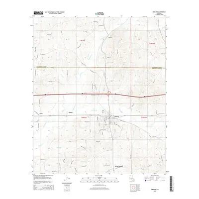
2015 Map of Gibsland
USGS Topo · Published 2015About this map
Gibsland serves as the primary hub of this North Louisiana landscape, where the intersection of major transportation routes highlights the town's historical development. The settlement pattern follows the drainage of Black Lake Cr and its tributaries, including Leatherman Cr and the descriptively named Hurried Br. To the south, the community of Mount Lebanon preserves a distinct local identity near the Whitley Cem, while northern reaches of the quadrangle transition into the more sparsely populated areas around Darley.
Find a feature on this map
81 named features on this map. Tap any name to fly to it.
Don’t see what you’re looking for? This feature index may not catch every label — zoom into the map to look around manually.
Map Details
Editions of this 2015 Gibsland Map
This is the sole edition of this map. No revisions or reprints were ever made.
Other maps of this area

1947 · Bienville
USGS Topo · 1:62,500

1948 · Jamestown
USGS Topo · 1:62,500

1949 · Jamestown
USGS Topo · 1:62,500

1949 · Bienville
USGS Topo · 1:62,500

1949 · Gibsland
USGS Topo · 1:62,500

1950 · Gibsland
USGS Topo · 1:62,500

1950 · Arcadia
USGS Topo · 1:62,500

1951 · Arcadia
USGS Topo · 1:62,500

1955 · Shreveport
USGS Topo · 1:250,000

1956 · Shreveport
USGS Topo · 1:250,000