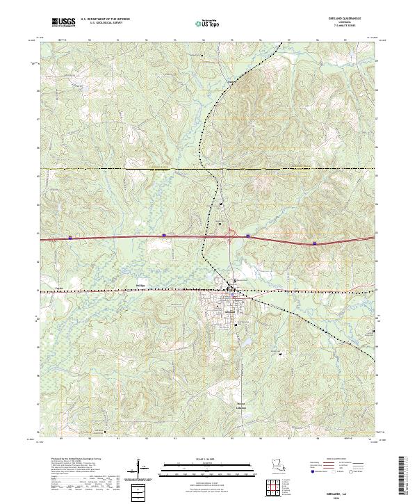
2024 Map of Gibsland
USGS Topo · Published 2024About this map
Gibsland serves as the central hub of this landscape, situated at the boundary where Claiborne Parish and Bienville Parish meet. The area is defined by a high density of local family and community landmarks, particularly evident in the many burial grounds such as Palestine Church Cem, Holstun Family Cem, and Walker Community Cem. These sites, along with Oak Grove Church, suggest a deeply rooted rural social structure that has persisted around the settlements of Mount Lebanon and Taylor. The topography is marked by a network of waterways including Black Lake Creek and Leatherman Creek, which drain the timbered terrain. This survey provides a contemporary view of the intersection of interstate transit and traditional parish life, where major transit corridors cross near long-established communities like Phillips and Darley.
Find a feature on this map
70 named features on this map. Tap any name to fly to it.
Don’t see what you’re looking for? This feature index may not catch every label — zoom into the map to look around manually.
Map Details
Editions of this 2024 Gibsland Map
This is the sole edition of this map. No revisions or reprints were ever made.
Other maps of this area

1947 · Bienville
USGS Topo · 1:62,500

1948 · Jamestown
USGS Topo · 1:62,500

1949 · Jamestown
USGS Topo · 1:62,500

1949 · Bienville
USGS Topo · 1:62,500

1949 · Gibsland
USGS Topo · 1:62,500

1950 · Gibsland
USGS Topo · 1:62,500

1950 · Arcadia
USGS Topo · 1:62,500

1951 · Arcadia
USGS Topo · 1:62,500

1955 · Shreveport
USGS Topo · 1:250,000

1956 · Shreveport
USGS Topo · 1:250,000