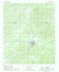
1986 Map of Gibsland
USGS Topo · Published 1986About this map
Gibsland and Mt Lebanon serve as the primary focal points in this mid-1980s survey of Bienville Parish. The landscape is defined by a dense network of watercourses, including Leatherman Creek and Black Lake Creek, which dictate the local topography and settlement patterns. The map highlights the transit corridor through Taylor and Phillips, showing the intersection of local roads like 80 and 154 with the surrounding rural terrain. A clear boundary line marks the division between Claiborne Parish and Bienville Parish at the northern edge.
Find a feature on this map
21 named features on this map. Tap any name to fly to it.
Don’t see what you’re looking for? This feature index may not catch every label — zoom into the map to look around manually.
Map Details
Editions of this 1986 Gibsland Map
This is the sole edition of this map. No revisions or reprints were ever made.
Other maps of this area

1947 · Bienville
USGS Topo · 1:62,500

1948 · Jamestown
USGS Topo · 1:62,500

1949 · Jamestown
USGS Topo · 1:62,500

1949 · Bienville
USGS Topo · 1:62,500

1949 · Gibsland
USGS Topo · 1:62,500

1950 · Gibsland
USGS Topo · 1:62,500

1950 · Arcadia
USGS Topo · 1:62,500

1951 · Arcadia
USGS Topo · 1:62,500

1955 · Shreveport
USGS Topo · 1:250,000

1956 · Shreveport
USGS Topo · 1:250,000