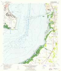
1956 Map of Gibsonton
USGS Topo · Published 1957About this map
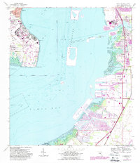
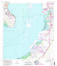
Mac Dill Air Force Base occupies the western peninsula in this mid-century survey, its expansive airfield and hospital facilities overlooking the waters of Hillsborough Bay. Across the bay to the east, the shoreline is defined by a series of small coastal communities and industrial sites where the Alafia River meets the coast. The presence of a large Tailings Pond near East Tampa and multiple Fish Hatchery locations inland suggests a diverse local economy balancing phosphate processing and aquaculture. Small settlements like Gibsonton, Gardenville, and Adamsville are connected by the Atlantic Coast Line railroad, which runs parallel to the coast. The coastal wetlands are intricate, featuring named features such as The Kitchen, Whisky Stump Key, and Big Bend, while numerous drainage branches like Bullfrog Creek and Jackson Branch weave through the agricultural and residential plots of North Ruskin.
Find a feature on this map
41 named features on this map. Tap any name to fly to it.
Don’t see what you’re looking for? This feature index may not catch every label — zoom into the map to look around manually.
Map Details
Editions of this 1956 Gibsonton Map
6 editions found
Other maps of this area

1921 · Tampa
USGS Topo · 1:62,500

1921 · Fort De Soto
USGS Topo · 1:62,500

1921 · St Petersburg
USGS Topo · 1:62,500

1942 · Cockroach Bay
USGS Topo · 1:31,680

1943 · Gandy Bridge
USGS Topo · 1:31,680

1943 · Port Tampa
USGS Topo · 1:31,680

1944 · Mango
USGS Topo · 1:31,680

1944 · Ruskin
USGS Topo · 1:31,680

1944 · Tampa
USGS Topo · 1:31,680

1944 · Wimauma
USGS Topo · 1:31,680