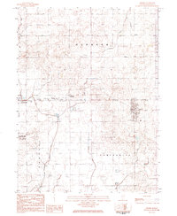
1984 Map of Gifford
USGS Topo · Published 1985About this map
Agricultural lands and the expanding footprint of the Chanute AFB airfield dominate this eastern Illinois landscape in the early 1980s. The village of Gifford serves as a local hub, featuring Roessler Memorial Park and the central post office. To the west, the village of Rantoul borders the base, while smaller settlements like Dillsburg and a Trailer Park occupy the space between.
Find a feature on this map
28 named features on this map. Tap any name to fly to it.
Don’t see what you’re looking for? This feature index may not catch every label — zoom into the map to look around manually.
Map Details
Editions of this 1984 Gifford Map
This is the sole edition of this map. No revisions or reprints were ever made.
Other maps of this area

1906 · Urbana
USGS Topo · 1:62,500

1924 · Paxton
USGS Topo · 1:62,500

1927 · Paxton
USGS Topo · 1:62,500

1931 · Fithian
USGS Topo · 1:48,000

1936 · Potomac
USGS Topo · 1:62,500

1943 · Fithian
USGS Topo · 1:62,500

1949 · Paxton
USGS Topo · 1:62,500

1953 · Danville
USGS Topo · 1:250,000

1955 · Danville
USGS Topo · 1:250,000

1956 · Danville
USGS Topo · 1:250,000