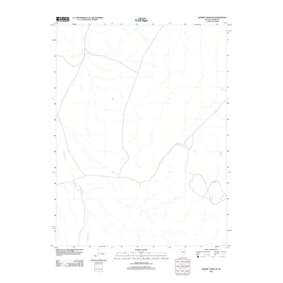
2011 Map of Gilbert Creek SE
USGS Topo · Published 2011About this map
Antelope Creek meanders through this portion of Lander County, Nevada, defining the primary drainage pattern of this high-desert landscape. In a region where water sources are vital historical markers, Rocky Gap Spring and Caton Spring appear as critical points of interest. This 2011 topographic survey by the U.S. Geological Survey illustrates a network of local roads and unimproved trails that traverse the terrain, suggesting a landscape primarily shaped by cattle ranching or mineral exploration. The presence of named springs highlights the sparse but essential hydrology that once supported early travel and habitation through these northern Nevada basins.
Find a feature on this map
3 named features on this map. Tap any name to fly to it.
Don’t see what you’re looking for? This feature index may not catch every label — zoom into the map to look around manually.
Map Details
Editions of this 2011 Gilbert Creek SE Map
This is the sole edition of this map. No revisions or reprints were ever made.
Other maps of this area

1955 · Millett
USGS Topo · 1:250,000

1959 · Millett
USGS Topo · 1:250,000

1969 · Manhattan Mtn
USGS Topo · 1:24,000

1969 · Gilbert Creek SE
USGS Topo · 1:24,000
1969 · Manhattan Mtn NW
USGS Topo · 1:24,000

1969 · Gilbert Creek SW
USGS Topo · 1:24,000
1969 · Gilbert Creek NW
USGS Topo · 1:24,000
1969 · Gilbert Creek NE
USGS Topo · 1:24,000

1969 · Vigus Butte NW
USGS Topo · 1:24,000

1969 · Mount Airy NW
USGS Topo · 1:24,000