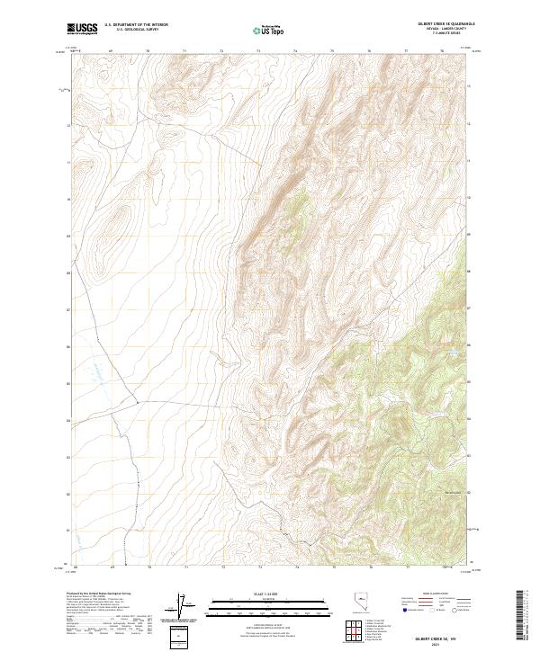
2021 Map of Gilbert Creek SE
USGS Topo · Published 2021About this map
Ravenswood sits at the foot of the high ridges in this section of Lander County, marking a point of human presence in a landscape defined by dramatic elevation changes. The terrain is characterized by steep, dissected slopes where water sources like Rocky Gap Spring and Caton Spring appear along the eastern drainages. These isolated springs are critical landmarks in the arid high-desert environment, where seasonal flow from Antelope Cr and Gilbert Cr shapes the alluvial fans below. The map clearly delineates the Public Land Survey System grid, including townships t23n r41e and t22n r42e, which historically governed land claims and grazing rights in this part of Nevada. The sparse distribution of named features underscores the remote character of this region, where survival was often tied to the precise locations of the few reliable water points scattered throughout the hills.
Find a feature on this map
9 named features on this map. Tap any name to fly to it.
Don’t see what you’re looking for? This feature index may not catch every label — zoom into the map to look around manually.
Map Details
Editions of this 2021 Gilbert Creek SE Map
This is the sole edition of this map. No revisions or reprints were ever made.
Other maps of this area

1955 · Millett
USGS Topo · 1:250,000

1959 · Millett
USGS Topo · 1:250,000

1969 · Manhattan Mtn
USGS Topo · 1:24,000

1969 · Gilbert Creek SE
USGS Topo · 1:24,000
1969 · Manhattan Mtn NW
USGS Topo · 1:24,000

1969 · Gilbert Creek SW
USGS Topo · 1:24,000
1969 · Gilbert Creek NW
USGS Topo · 1:24,000
1969 · Gilbert Creek NE
USGS Topo · 1:24,000

1969 · Vigus Butte NW
USGS Topo · 1:24,000

1969 · Mount Airy NW
USGS Topo · 1:24,000