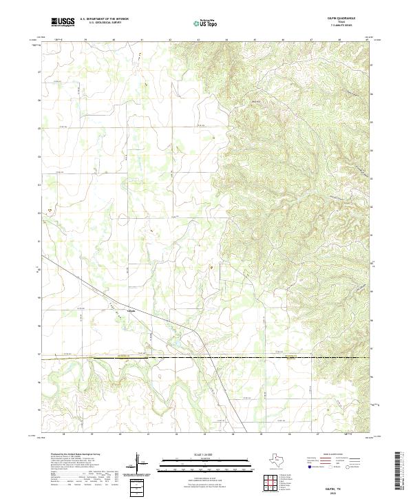
2022 Map of Gilpin
USGS Topo · Published 2022About this map
Gilpin sits at the intersection of rural transit and rugged West Texas terrain, serving as the primary named settlement in this corner of Dickens County. The landscape is defined by a series of deep drainages and breaks, most notably the network of canyons carving through the eastern half of the sheet, including John Bell Canyon and the evocatively named Getaway Canyon. These natural features, alongside Dark Canyon and JTH Canyon, reflect the erosive power of seasonal water moving across the plains toward lower elevations. The hydrology is dominated by the winding course of Dry Duck Cr and the broad path of Sage Draw, which cut through the flatter ranching lands to the west. Rising above the surrounding breaks, Red Hill provides a distinct topographic landmark in an area otherwise characterized by its intricate system of coulees and draws.
Find a feature on this map
9 named features on this map. Tap any name to fly to it.
Don’t see what you’re looking for? This feature index may not catch every label — zoom into the map to look around manually.
Map Details
Editions of this 2022 Gilpin Map
This is the sole edition of this map. No revisions or reprints were ever made.
Other maps of this area

1954 · Lubbock
USGS Topo · 1:250,000

1958 · Pursley House
USGS Topo · 1:24,000

1958 · Jayton
USGS Topo · 1:24,000

1959 · Gilpin
USGS Topo · 1:24,000

1959 · Girard
USGS Topo · 1:24,000

1967 · Dickens South
USGS Topo · 1:24,000

1967 · Spur
USGS Topo · 1:24,000

1968 · Pitchfork Ranch
USGS Topo · 1:24,000

1968 · White Camp
USGS Topo · 1:24,000

1968 · Croton Camp
USGS Topo · 1:24,000