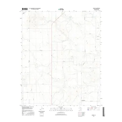
2016 Map of Ginsite
USGS Topo · Published 2016About this map
Sneedville sits near the southern edge of this Cottle County landscape, where the prairie is deeply etched by a network of drainage systems. The N Wichita River cuts through the southeastern corner, fed by the winding courses of Salt Cr, Buck Cr, and S Buck Cr. These waterways create a complex topography of draws and breaks typical of the rolling plains of West Texas. Historically significant sites like the Buck Creek Cem are preserved here, offering a focal point for genealogical research in this sparsely populated region. The map also features Richards Lake in the north, providing a rare permanent water source amidst a grid of ranch and county roads such as Ranch Rd 1038 and FM 1168.
Find a feature on this map
32 named features on this map. Tap any name to fly to it.
Don’t see what you’re looking for? This feature index may not catch every label — zoom into the map to look around manually.
Map Details
Editions of this 2016 Ginsite Map
This is the sole edition of this map. No revisions or reprints were ever made.
Other maps of this area

1954 · Lubbock
USGS Topo · 1:250,000

1954 · Plainview
USGS Topo · 1:250,000

1958 · Plainview
USGS Topo · 1:250,000
1966 · Chalk SW
USGS Topo · 1:24,000
1966 · Devils Canyon
USGS Topo · 1:24,000
1967 · Paducah
USGS Topo · 1:24,000
1967 · Moons Camp
USGS Topo · 1:24,000
1968 · Grow
USGS Topo · 1:24,000
1968 · Chalk
USGS Topo · 1:24,000
1968 · Buffalo Creek
USGS Topo · 1:24,000