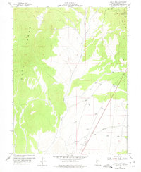
1958 Map of Giroux Wash
USGS Topo · Published 1975About this map
The Egan Range dominates this mid-century landscape of White Pine County, where the high-elevation terrain is cut by a network of drainage channels. Water remains the defining force of the geography, from the primary Giroux Wash and White River Wash to smaller seasonal flows like Sage Hen Spring Wash and Lion Wash. Human activity in this arid environment is sparsely marked but significant, centered around infrastructure like the Landing Strip and a Radio Relay Sta located near Rib Hill. While much of the land remains undeveloped, the presence of a Gravel Pit and scattered wells suggests the extraction and resource management typical of the eastern Nevada interior. The topography, mapped during the tenure of Governor Grant Sawyer, reveals the intricate natural contours of Holt Creek and the southern extent of the range before modern expansion.
Find a feature on this map
14 named features on this map. Tap any name to fly to it.
Don’t see what you’re looking for? This feature index may not catch every label — zoom into the map to look around manually.
Map Details
Editions of this 1958 Giroux Wash Map
2 editions found
Other maps of this area

1952 · Ely
USGS Topo · 1:125,000

1956 · Ely
USGS Topo · 1:250,000

1958 · Ruth
USGS Topo · 1:24,000

1958 · Ely
USGS Topo · 1:62,500

1958 · McGill
USGS Topo · 1:62,500

1958 · Reipetown
USGS Topo · 1:24,000

1958 · Giroux Wash
USGS Topo · 1:24,000

1958 · Ely
USGS Topo · 1:24,000

1959 · Ely
USGS Topo · 1:250,000

1959 · Reipetown
USGS Topo · 1:62,500