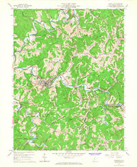
1965 Map of Glenville
USGS Topo · Published 1967About this map
The Little Kanawha River meanders through Gilmer County, serving as the primary geographic corridor for settlements like Glenville, Truebada, and Sand Fork in the mid-1960s. The town of Glenville is dominated by the campus of Glenville State College, while the surrounding hills are heavily marked by the energy and extractive industries of the era. Numerous gas wells and compressor stations dot the landscape, alongside several strip mines and a Quarry near Sand Fork.
Find a feature on this map
62 named features on this map. Tap any name to fly to it.
Don’t see what you’re looking for? This feature index may not catch every label — zoom into the map to look around manually.
Map Details
Editions of this 1965 Glenville Map
2 editions found
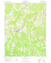
Other maps of this area

1893 · Sutton
USGS Topo · 1:125,000

1904 · Vadis
USGS Topo · 1:62,500

1906 · Holbrook
USGS Topo · 1:62,500

1906 · Glenville
USGS Topo · 1:62,500

1906 · Burnsville
USGS Topo · 1:62,500

1924 · Holbrook
USGS Topo · 1:62,500

1925 · Glenville
USGS Topo · 1:62,500

1925 · Burnsville
USGS Topo · 1:62,500

1925 · Vadis
USGS Topo · 1:62,500

1926 · Holbrook
USGS Topo · 1:62,500