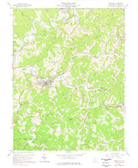
1965 Map of Glenville
USGS Topo · Published 1978About this map
Glenville serves as the focal point of this Gilmer County landscape, where the Little Kanawha River winds past Glenville State College and the local High School. The mid-1960s economy is etched into the hillsides through numerous Strip Mine operations and a network of gas wells and pipelines, particularly concentrated near Baldwin and Truebada. The topography is defined by sharp ridges like Powell Knob and deep hollows, with the Baltimore and Ohio rail line following the river valley through Sand Fork. In the southern reaches, Cedar Creek State Park provides a large recreational footprint near Duskcamp, while local life is further evidenced by scattered landmarks like the Drive-in Theater, Fairgrounds, and the County 4H Camp. This survey documents a transition in West Virginia's interior, balancing educational growth with intensive resource extraction.
Find a feature on this map
67 named features on this map. Tap any name to fly to it.
Don’t see what you’re looking for? This feature index may not catch every label — zoom into the map to look around manually.
Map Details
Editions of this 1965 Glenville Map
2 editions found
Other maps of this area

1893 · Sutton
USGS Topo · 1:125,000

1904 · Vadis
USGS Topo · 1:62,500

1906 · Holbrook
USGS Topo · 1:62,500

1906 · Glenville
USGS Topo · 1:62,500

1906 · Burnsville
USGS Topo · 1:62,500

1924 · Holbrook
USGS Topo · 1:62,500

1925 · Glenville
USGS Topo · 1:62,500

1925 · Burnsville
USGS Topo · 1:62,500

1925 · Vadis
USGS Topo · 1:62,500

1926 · Holbrook
USGS Topo · 1:62,500