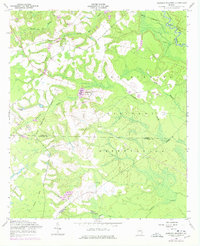
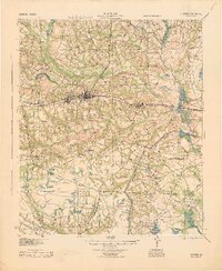
1958 Map of Glissons Millpond
USGS Topo · Published 1977About this map
Fort Stewart Military Reservation dominates the eastern half of this Georgia landscape, its boundary lines cutting across a topography defined by slow-moving creek systems and family-named water bodies. The presence of Glissons Millpond and Barnard Mill (Big) Branch points to the area's agricultural and industrial heritage, where early residents harnessed local waterways for power. Local history and genealogy are anchored by several notable sites, including Barnard Cem, Antioch Sch Cem, and the Antioch Sch. Aviation and military use are clearly marked by the Lawrence Airfield, an Airstrip, and the landmark Tower at Camp Oliver. Transport evolution is visible in the southwest, where an Old Railroad Grade remains as a linear scar through the woods, while the Canoochee River winds through the wetlands near the Bryan County line.
Find a feature on this map
26 named features on this map. Tap any name to fly to it.
Don’t see what you’re looking for? This feature index may not catch every label — zoom into the map to look around manually.
Map Details
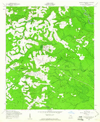
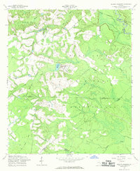
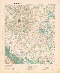
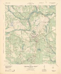
Editions of this 1958 Glissons Millpond Map
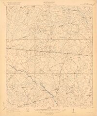
Other maps of this area

1918 · Hinesville
USGS Topo · 1:62,500

1919 · Claxton
USGS Topo · 1:62,500
1920 · Pembroke
USGS Topo · 1:62,500

1920 · Glennville
USGS Topo · 1:62,500
1944 · Claxton
USGS Topo · 1:62,500
1944 · Glennville
USGS Topo · 1:62,500
1944 · Hinesville
USGS Topo · 1:62,500

1946 · Brunswick
USGS Topo · 1:250,000

1947 · Savannah
USGS Topo · 1:250,000

1948 · Brunswick
USGS Topo · 1:250,000