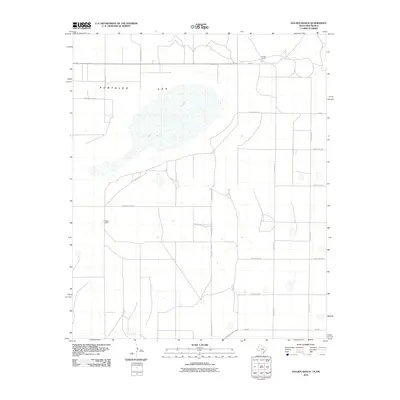
2010 Map of Golden Ranch
USGS Topo · Published 2010About this map
Salt Lake dominates the central landscape of this Eastern New Mexico quadrangle, situated within the Portales Ley depression. The area exhibits the characteristic high plains pattern of large-scale ranching and a grid of rural section roads typical of Roosevelt County. The eponymous Golden Ranch is located in the northern portion of the sheet near FM-746, while Nickles Ranch serves as another primary landmark to the southwest. This 2010 survey reflects the enduring spatial organization of the Llano Estacado, where water features like Salt Lake dictate the local topography and historical land use. A dense network of numbered routes, including S Roosevelt Road 11 and County RD-11, connects these isolated ranching outposts across the arid terrain.
Find a feature on this map
18 named features on this map. Tap any name to fly to it.
Don’t see what you’re looking for? This feature index may not catch every label — zoom into the map to look around manually.
Map Details
Editions of this 2010 Golden Ranch Map
This is the sole edition of this map. No revisions or reprints were ever made.
Other maps of this area

1954 · Clovis
USGS Topo · 1:250,000

1954 · Brownfield
USGS Topo · 1:250,000

1957 · Arch
USGS Topo · 1:62,500

1958 · Brownfield
USGS Topo · 1:250,000

1958 · Clovis
USGS Topo · 1:250,000

1962 · Brownfield
USGS Topo · 1:250,000

1962 · Stegall
USGS Topo · 1:24,000

1962 · Birdwell Ranch
USGS Topo · 1:24,000

1968 · Three Way School
USGS Topo · 1:24,000

1970 · Causey East
USGS Topo · 1:24,000