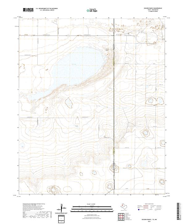
2022 Map of Golden Ranch
USGS Topo · Published 2022About this map
Salt Lake sits at the heart of this high plains landscape, a prominent hydrological feature within the broader Portales Valley. This 2022 survey captures the borderlands where Roosevelt County, New Mexico, meets Bailey County, Texas. The terrain is defined by its wide, open character and a strictly gridded network of rural roads that straddle the state line. On the New Mexico side, routes like S Roosevelt Rd 10 and S Roosevelt Rd 14 provide access to the interior rangelands, while the Texas side is serviced by secondary highways including Fm 746 and Fm 298. The map documents the persistent agricultural and ranching layout of the Llano Estacado, showing how state boundaries and township lines like t2s r37e and t3s r37e have dictated the development and movement across this arid region.
Find a feature on this map
20 named features on this map. Tap any name to fly to it.
Don’t see what you’re looking for? This feature index may not catch every label — zoom into the map to look around manually.
Map Details
Editions of this 2022 Golden Ranch Map
This is the sole edition of this map. No revisions or reprints were ever made.
Other maps of this area

1954 · Clovis
USGS Topo · 1:250,000

1954 · Brownfield
USGS Topo · 1:250,000

1957 · Arch
USGS Topo · 1:62,500

1958 · Brownfield
USGS Topo · 1:250,000

1958 · Clovis
USGS Topo · 1:250,000

1962 · Brownfield
USGS Topo · 1:250,000

1962 · Stegall
USGS Topo · 1:24,000

1962 · Birdwell Ranch
USGS Topo · 1:24,000

1968 · Three Way School
USGS Topo · 1:24,000

1970 · Causey East
USGS Topo · 1:24,000