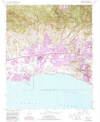
1950 Map of Goleta
USGS Topo · Published 1989About this map
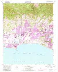
The Santa Barbara Airport and the surrounding coastal terrace define this landscape, where the Santa Barbara Channel meets the foothills of the Santa Ynez Mountains. Based on 1947 photography and a 1950 field check, with later urban revisions, the map documents the area during a period of significant post-war transition. Traditional land divisions like the Los Dos Pueblos and Pueblo Lands of Santa Barbara grants are still prominent, overlaying a developing network of roads like Hollister Avenue. The hydrological system is intricately mapped, showing how Atascadero Creek and Maria Ygnacio Creek drain into the Goleta Slough near Mescalitan Island. From the established Goleta settlement to the residential enclaves of Hope Ranch and Isla Vista, the map provides a clear record of coastal development and agricultural land use before the full surge of late-century suburbanization.
Find a feature on this map
52 named features on this map. Tap any name to fly to it.
Don’t see what you’re looking for? This feature index may not catch every label — zoom into the map to look around manually.
Map Details
Editions of this 1950 Goleta Map
6 editions found
Other maps of this area

1902 · Santa Ynez
USGS Topo · 1:125,000

1905 · Santa Ynez
USGS Topo · 1:125,000

1941 · San Rafael Mtn.
USGS Topo · 1:62,500

1942 · Goleta
USGS Topo · 1:62,500

1942 · San Rafael Mtn.
USGS Topo · 1:62,500

1942 · Little Pine Mountain
USGS Topo · 1:24,000

1943 · San Rafael Mtn.
USGS Topo · 1:62,500

1944 · Santa Barbara
USGS Topo · 1:31,680
1944 · Little Pine Mountain
USGS Topo · 1:31,680

1949 · Los Angeles
USGS Topo · 1:250,000