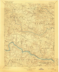
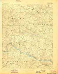
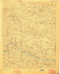
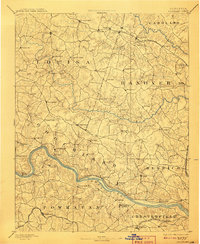
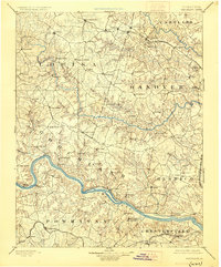
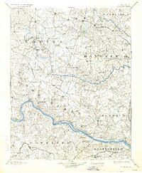
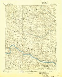
1892 Map of Goochland
USGS Topo · Published 1918About this map
The James River and its major tributaries, the South Anna River and North Anna River, define the landscape of Central Virginia in this late nineteenth-century survey. The region is characterized by a dense network of small rural communities and crossroad settlements such as Gardners X Roads and Thompsons X Roads. Significant transportation arteries include the Chesapeake and Ohio Railroad cutting through the northern section and the Richmond and Alleghany Railroad following the banks of the James. Notable local landmarks like the Hanover Academy, the mineral waters of Huguenot Springs, and the industrial footprint of the Coal Pits in Henrico provide insight into the social and economic fabric of the era. The mapping of Emmetts Dam and Beaver Dam further illustrates the historical management of the region's abundant water resources.
Find a feature on this map
95 named features on this map. Tap any name to fly to it.
Don’t see what you’re looking for? This feature index may not catch every label — zoom into the map to look around manually.
Map Details
Editions of this 1892 Goochland Map
8 editions found
Other maps of this area

1887 · Spottsylvania
USGS Topo · 1:125,000

1889 · Fredericksburg
USGS Topo · 1:125,000

1890 · Goochland
USGS Topo · 1:125,000

1891 · Palmyra
USGS Topo · 1:125,000

1891 · Farmville
USGS Topo · 1:125,000

1892 · Fredericksburg
USGS Topo · 1:125,000

1892 · Spottsylvania
USGS Topo · 1:125,000

1892 · Goochland
USGS Topo · 1:125,000

1892 · Gordonsville
USGS Topo · 1:125,000

1893 · Farmville
USGS Topo · 1:125,000