
1918 Map of Good Hope
USGS Topo · Published 1918About this map
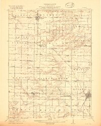
The Warren Co McDonough Co Boundary Line divides this 1918 landscape of intensive Midwestern agriculture and small-town commerce. Regional hubs like Roseville, Bushnell, and Good Hope anchor a grid of rural section lines, each punctuated by numerous country schoolhouses and churches. The map documents an era of peak rural education, naming unique institutions such as Mud College, Chattanooga School, and Sugarloaf School.
Find a feature on this map
79 named features on this map. Tap any name to fly to it.
Don’t see what you’re looking for? This feature index may not catch every label — zoom into the map to look around manually.
Map Details
Editions of this 1918 Good Hope Map
2 editions found
Other maps of this area

1912 · Macomb
USGS Topo · 1:62,500

1913 · Colchester
USGS Topo · 1:62,500

1914 · Macomb
USGS Topo · 1:62,500

1915 · Avon
USGS Topo · 1:62,500

1916 · Good Hope
USGS Topo · 1:62,500

1918 · Vermont
USGS Topo · 1:62,500

1918 · La Harpe
USGS Topo · 1:62,500

1921 · Vermont
USGS Topo · 1:62,500

1921 · Monmouth
USGS Topo · 1:62,500

1923 · Monmouth
USGS Topo · 1:62,500