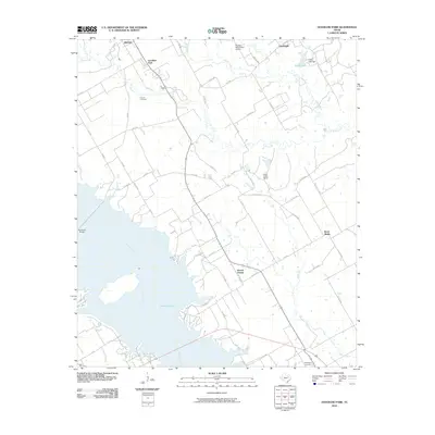
2010 Map of Goodlow Park
USGS Topo · Published 2010About this map
Lake Corsicana dominates the southwestern quadrant of this landscape, its fingers reaching into the surrounding Navarro County countryside along Chambers Creek and Long Arm Branch. This area reflects a quiet rural character defined by small communities like Goodlow Park, Rural Shade, and Round Prairie, connected by a network of farm roads and county lanes. The terrain is marked by a complex drainage system, where Rush Creek, Alligator Creek, and Gas Creek flow toward the larger reservoir.
Find a feature on this map
64 named features on this map. Tap any name to fly to it.
Don’t see what you’re looking for? This feature index may not catch every label — zoom into the map to look around manually.
Map Details
Editions of this 2010 Goodlow Park Map
This is the sole edition of this map. No revisions or reprints were ever made.
Other maps of this area

1954 · Dallas
USGS Topo · 1:250,000

1954 · Waco
USGS Topo · 1:250,000

1955 · Waco
USGS Topo · 1:250,000

1958 · Dallas
USGS Topo · 1:250,000

1959 · Powell
USGS Topo · 1:24,000

1960 · Winkler
USGS Topo · 1:24,000

1960 · Streetman
USGS Topo · 1:24,000

1960 · Creslenn Ranch
USGS Topo · 1:24,000

1960 · Goodlow Park
USGS Topo · 1:24,000

1960 · Malakoff
USGS Topo · 1:24,000