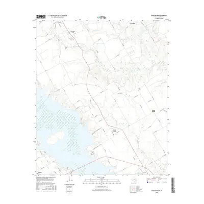
2016 Map of Goodlow Park
USGS Topo · Published 2016About this map
Lake Corsicana dominates the southwestern quadrant of this 2016 survey, its irregular shoreline reaching toward the established settlements of Kerens and Goodlow. The landscape is a network of rural routes and watercourses, defined by the winding paths of Rush Cr, Indian Cr, and Alligator Cr. Local history is anchored by several burial grounds, including Kerens Cem in the northwest and Petersburg Cem near Texas Industries Lake to the south. The transition from the developed streets of Goodlow Park to the outlying communities of Round Prairie and Rural Shade illustrates the persistent agrarian character of Navarro County. Along the eastern edge, the terrain remains largely open, marked by small water bodies like Hoffer Lake and the intermittent flow of Gas Cr and Gus Cr.
Find a feature on this map
93 named features on this map. Tap any name to fly to it.
Don’t see what you’re looking for? This feature index may not catch every label — zoom into the map to look around manually.
Map Details
Editions of this 2016 Goodlow Park Map
This is the sole edition of this map. No revisions or reprints were ever made.
Other maps of this area

1954 · Dallas
USGS Topo · 1:250,000

1954 · Waco
USGS Topo · 1:250,000

1955 · Waco
USGS Topo · 1:250,000

1958 · Dallas
USGS Topo · 1:250,000

1959 · Powell
USGS Topo · 1:24,000

1960 · Winkler
USGS Topo · 1:24,000

1960 · Streetman
USGS Topo · 1:24,000

1960 · Creslenn Ranch
USGS Topo · 1:24,000

1960 · Goodlow Park
USGS Topo · 1:24,000

1960 · Malakoff
USGS Topo · 1:24,000