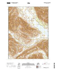
2019 Map of Goodnews Bay B-1 NE
USGS Topo · Published 2019About this map
Lake Aleknagik anchors the eastern edge of this terrain, marking a significant transition in the Dillingham Census Area where high-elevation slopes meet the water. The landscape is defined by a dense network of high-country drainage, with Sunshine Cr and Billie Cr flowing out of the Sunshine Valley toward the lake. Further west, the drainage system shifts toward the south and west as Youth Cr, Zane Cr, and Ice Cr carve through the ridgelines. The map provides a detailed view of the Public Land Survey System divisions, including sections of t8s r58w and t9s r58w, illustrating how these remote Alaskan wilderness areas are legally partitioned amidst the complex topography of the Wood-Tikchik region.
Find a feature on this map
14 named features on this map. Tap any name to fly to it.
Don’t see what you’re looking for? This feature index may not catch every label — zoom into the map to look around manually.
Map Details
Editions of this 2019 Goodnews Bay B-1 NE Map
This is the sole edition of this map. No revisions or reprints were ever made.
Other maps of this area

1951 · Dillingham
USGS Topo · 1:250,000

1951 · Goodnews
USGS Topo · 1:250,000

1954 · Dillingham
USGS Topo · 1:250,000

1954 · Dillingham B-8
USGS Topo · 1:63,360

1954 · Dillingham C-8
USGS Topo · 1:63,360

1979 · Goodnews Bay B-1
USGS Topo · 1:63,360

1979 · Goodnews Bay
USGS Topo · 1:250,000

1979 · Goodnews Bay C-1
USGS Topo · 1:63,360
2019 · Dillingham C-8 SW
USGS Topo · 1:25,000
2019 · Goodnews Bay C-1 SW
USGS Topo · 1:25,000