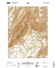
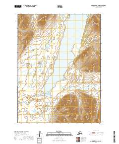
2019 Map of Goodnews Bay B-3 NE
USGS Topo · Published 2019About this map
The Togiak River winds through the heart of this landscape in the Dillingham Census Area, forming a complex network of braids and oxbows that characterize the region's hydrography. The terrain is defined by the convergence of several significant watercourses, including the Tshugajaguk River and the Nayorurun River, which flow across the northern and central sections. To the southeast, the Onoivivuk River emerges, further illustrating the intricate drainage patterns of this Alaskan wilderness. This 2019 survey provides a precise look at the shifting river channels and land divisions within t8s r63w, t8s r62w, t9s r63w, and t9s r62w, offering a clear snapshot of the natural environment and its boundaries in the early twenty-first century.
Find a feature on this map
8 named features on this map. Tap any name to fly to it.
Don’t see what you’re looking for? This feature index may not catch every label — zoom into the map to look around manually.
Map Details
Editions of this 2019 Goodnews Bay B-3 NE Map
This is the sole edition of this map. No revisions or reprints were ever made.
Other maps of this area

1951 · Goodnews
USGS Topo · 1:250,000

1954 · Goodnews B-3
USGS Topo · 1:63,360

1954 · Goodnews C-2
USGS Topo · 1:63,360

1979 · Goodnews Bay B-2
USGS Topo · 1:63,360

1979 · Goodnews Bay C-3
USGS Topo · 1:63,360

1979 · Goodnews Bay
USGS Topo · 1:250,000
2019 · Goodnews Bay C-3 SE
USGS Topo · 1:25,000
2019 · Goodnews Bay B-3 SE
USGS Topo · 1:25,000
2019 · Goodnews Bay B-2 SW
USGS Topo · 1:25,000
2019 · Goodnews Bay C-2 SW
USGS Topo · 1:25,000