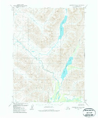
1979 Map of Goodnews Bay D-2
USGS Topo · Published 1979About this map
The Izavieknik River drainage defines this Alaskan landscape, connecting high-altitude waters in a region of significant elevation change. This 1970s survey captures the untouched glacial topography between High Lake and the northern reaches of Upper Togiak Lake. The lack of permanent settlements or modern road infrastructure is notable; the only sign of human passage is a single marked Trail that follows the valley floor of Trail Creek, crossing the central portion of the quadrangle. This interior wilderness represents a period when mapping relied on photogrammetric methods from 1973 aerial photography to delineate the complex drainages and swampy lowlands of the Togiak region before modern development or intensive recreational use.
Find a feature on this map
5 named features on this map. Tap any name to fly to it.
Don’t see what you’re looking for? This feature index may not catch every label — zoom into the map to look around manually.
Map Details
Editions of this 1979 Goodnews Bay D-2 Map
2 editions found

Other maps of this area

1950 · Bethel
USGS Topo · 1:250,000

1951 · Goodnews
USGS Topo · 1:250,000

1954 · Goodnews C-2
USGS Topo · 1:63,360

1979 · Bethel A-3
USGS Topo · 1:63,360

1979 · Goodnews Bay D-3
USGS Topo · 1:63,360

1979 · Bethel A-1
USGS Topo · 1:63,360

1979 · Bethel A-2
USGS Topo · 1:63,360

1979 · Goodnews Bay D-1
USGS Topo · 1:63,360

1979 · Goodnews Bay C-3
USGS Topo · 1:63,360

1979 · Goodnews Bay
USGS Topo · 1:250,000