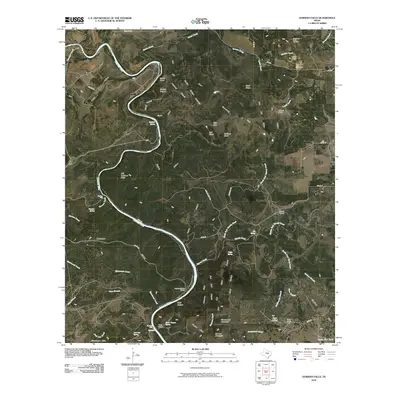
2010 Map of Gorman Falls
USGS Topo · Published 2010About this map
The Colorado River carves a dramatic path through this section of Burnet County, shaping a landscape defined by deep canyons and prominent limestone ridges. Near a sharp bend in the river, the notable Gorman Falls and Gorman Spring mark a significant hydrological focal point, while the surrounding terrain is punctuated by named features like Brahma Canyon and Windy Canyon. The presence of Southwest Ledge Quarries in the northeast suggests the area's geological utility, while several ranching and camp sites, including Jackson Ranch, Vann Ranch, and Lemons Springs Camp, indicate a land use pattern rooted in large-scale property ownership and seasonal river access. Transport across this uneven ground is facilitated by routes like Farm Rd 580 and various county roads that thread through the Ellenburger Hills and across numerous creek branches, including Yancey Creek and Cherokee Creek.
Find a feature on this map
75 named features on this map. Tap any name to fly to it.
Don’t see what you’re looking for? This feature index may not catch every label — zoom into the map to look around manually.
Map Details
Editions of this 2010 Gorman Falls Map
This is the sole edition of this map. No revisions or reprints were ever made.
Other maps of this area

1885 · San Saba
USGS Topo · 1:125,000

1887 · Llano
USGS Topo · 1:125,000

1887 · Lampasas
USGS Topo · 1:125,000

1887 · Burnet
USGS Topo · 1:125,000

1893 · Burnet
USGS Topo · 1:125,000

1894 · Lampasas
USGS Topo · 1:125,000

1894 · San Saba
USGS Topo · 1:125,000

1894 · Llano
USGS Topo · 1:125,000

1903 · Burnet
USGS Topo · 1:125,000

1904 · Llano
USGS Topo · 1:125,000