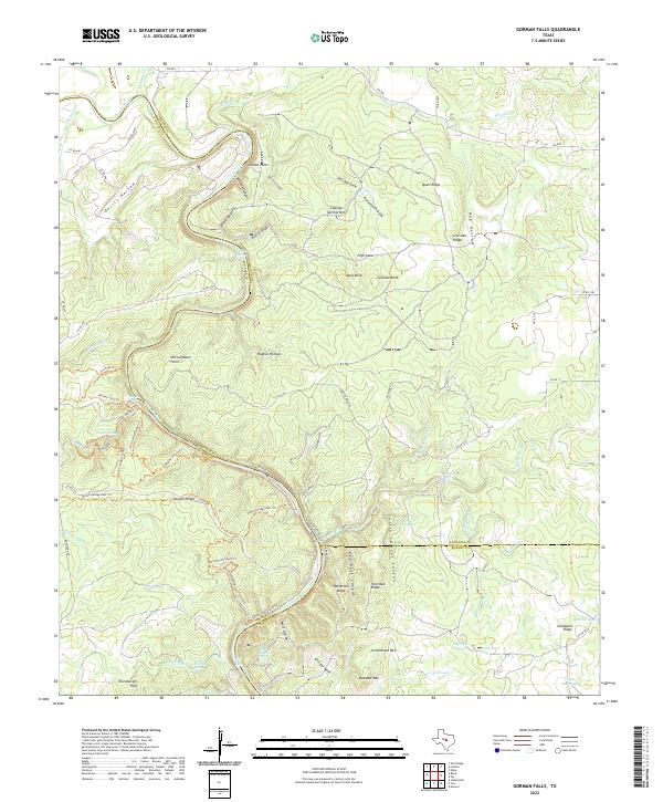
2022 Map of Gorman Falls
USGS Topo · Published 2022About this map
The Colorado River carves a deep, winding path through the limestone-dominated landscape where San Saba, Lampasas, and Burnet counties converge. This 2022 survey captures a territory defined by intricate canyon systems and natural water sources, most notably the Gorman Falls and its associated Gorman Spring complex. The area's hydrology is exceptionally dense, with numerous springs and ponds such as Patterson Springs, Cave Pond, and Spicewood Springs surfacing across the ridges. Higher elevations are marked by distinct peaks including Greenwood Mtn, Buzzard Mtn, and Charley Springs Mtn, while the terrain is dissected by deep cuts like Brahma Canyon and Devils Hollow. This map detail reveals a rugged Texas Hill Country environment largely defined by its drainage patterns and named geological points rather than dense urban settlement, with a complex network of recreational trails like the Cedar Chopper Loop Trl and Old Gorman Road Trl providing access to the river's edge.
Find a feature on this map
87 named features on this map. Tap any name to fly to it.
Don’t see what you’re looking for? This feature index may not catch every label — zoom into the map to look around manually.
Map Details
Editions of this 2022 Gorman Falls Map
This is the sole edition of this map. No revisions or reprints were ever made.
Other maps of this area

1885 · San Saba
USGS Topo · 1:125,000

1887 · Llano
USGS Topo · 1:125,000

1887 · Lampasas
USGS Topo · 1:125,000

1887 · Burnet
USGS Topo · 1:125,000

1893 · Burnet
USGS Topo · 1:125,000

1894 · Lampasas
USGS Topo · 1:125,000

1894 · San Saba
USGS Topo · 1:125,000

1894 · Llano
USGS Topo · 1:125,000

1903 · Burnet
USGS Topo · 1:125,000

1904 · Llano
USGS Topo · 1:125,000