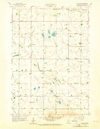
1958 Map of Gracelock
USGS Topo · Published 1964About this map
Gracelock anchors a rural landscape in Chippewa County defined by a regular grid of section-line roads and scattered marshy depressions. In the late 1950s, this area of western Minnesota maintained a dense network of one-room schoolhouses, including School No 318, School No 319, and School No 302, reflecting a time before full rural school consolidation. The social geography is further marked by community landmarks such as Buffalo Lake Ch and Havelock Ch, along with associated burial grounds like Hillside Cem and Havelock Cem. The terrain is characterized by its drainage into Dry Weather Cr and numerous unnamed potholes, while the local economy is evidenced by small industrial sites like the Gravel Pit near the township lines of Grace and Havelock.
Find a feature on this map
20 named features on this map. Tap any name to fly to it.
Don’t see what you’re looking for? This feature index may not catch every label — zoom into the map to look around manually.
Map Details
Editions of this 1958 Gracelock Map
3 editions found

Other maps of this area

1953 · New Ulm
USGS Topo · 1:250,000

1953 · Saint Cloud
USGS Topo · 1:250,000

1957 · Saint Cloud
USGS Topo · 1:250,000

1957 · New Ulm
USGS Topo · 1:250,000

1958 · New Ulm
USGS Topo · 1:250,000

1958 · Saint Cloud
USGS Topo · 1:250,000

1958 · Murdock
USGS Topo · 1:24,000

1958 · Gracelock NE
USGS Topo · 1:24,000

1958 · Kerkhoven SW
USGS Topo · 1:24,000

1958 · Gracelock NW
USGS Topo · 1:24,000