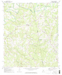
1969 Map of Graham
USGS Topo · Published 1973About this map
The Little Tallapoosa River winds through this rural borderland where Alabama meets Georgia, defining the landscape for the small communities of Graham and Ephesus. In the late 1960s, this area remained deeply rooted in its local institutions, evidenced by the high density of country churches and family burial grounds scattered throughout the hills. Religious life is particularly well-documented with landmarks like Bethlehem-Camp Ground Ch, Shiloh Ch, and the Old Shiloh Church.
Find a feature on this map
39 named features on this map. Tap any name to fly to it.
Don’t see what you’re looking for? This feature index may not catch every label — zoom into the map to look around manually.
Map Details
Editions of this 1969 Graham Map
3 editions found
Other maps of this area

1889 · Tallapoosa
USGS Topo · 1:125,000

1892 · Tallapoosa
USGS Topo · 1:125,000

1897 · Tallapoosa
USGS Topo · 1:125,000

1899 · Wedowee
USGS Topo · 1:125,000

1902 · Wedowee
USGS Topo · 1:125,000

1953 · Atlanta
USGS Topo · 1:250,000

1957 · Atlanta
USGS Topo · 1:250,000

1958 · Atlanta
USGS Topo · 1:250,000

1958 · Carrollton
USGS Topo · 1:62,500

1964 · Roopville
USGS Topo · 1:24,000